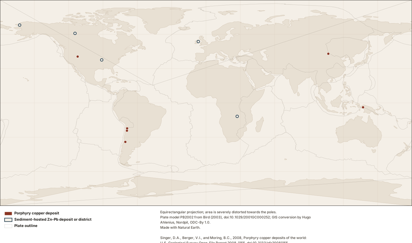
Each claim states how it is known and cites its evidence.
EstablishedDeposit-type code "17", in a codeset the metadata attributes to Cox and Singer (1986).
How a source classifies it
The USGS porphyry copper database records Bingham Canyon with deposit-type code "17". The metadata defines the field as a classification "using a system new to this report using the observed rocks reported in maps rather than characteristics that are frequently unobservable in yet-to-be discovered deposits", and gives its domain as a codeset reference — Cox and Singer (1986), doi:10.3133/b1693 — rather than as an enumeration. The metadata expands no code. Lithoen therefore records the code and its stated codeset, and does not state what "17" means.
- model: USGS Open-File Report 2008-1155, deptype field.
- source record: record bingham-canyon-deposit
- precision note: Bulletin 1693 has not been retrieved, so the expansion of this code into a named deposit type is unverified and is not asserted. An earlier version of this claim gave one — that expansion came from general knowledge, not from any source Lithoen had read.
- assertion basis: SOURCE_CLASSIFICATION
Evidence support: Supported by the cited evidence · 2 sources, single source
Evidence: Singer 2008 · Primary authority
Established0.882 wt%m Copper
Reported for this deposit
The USGS porphyry copper database gives Bingham Canyon an average copper grade of 0.882 percent. The compilers define this as the average grade of that metal for the deposit as a whole, over the ore tonnage they record — a deposit average, not an assay and not a reported resource grade.
- scope: depositAverage
- definition basis: The dataset’s attribute definition, which also states that a value of zero means the grade was unavailable.
- source record: record 670
- effective date: 2008-01-01
- assertion basis: SOURCE_REPORTED
Evidence support: Supported by the cited evidence · 2 sources, single source
Evidence: Singer 2008 · Primary authority
Established0.053 wt%m Molybdenum
Reported for this deposit
The USGS porphyry copper database gives Bingham Canyon an average molybdenum grade of 0.053 percent. The compilers define this as the average grade of that metal for the deposit as a whole, over the ore tonnage they record — a deposit average, not an assay and not a reported resource grade.
- scope: depositAverage
- definition basis: The dataset’s attribute definition, which also states that a value of zero means the grade was unavailable.
- source record: record 670
- effective date: 2008-01-01
- assertion basis: SOURCE_REPORTED
Evidence support: Supported by the cited evidence · 2 sources, single source
Evidence: Singer 2008 · Primary authority
EstablishedRecognised as a deposit by USGS Open-File Report 2008-1155, record 670.
How a source classifies it
Bingham Canyon is recorded as a deposit because the USGS porphyry copper database includes it, as record 670. That database admits only well explored deposits with enough information to help construct deposit models, and deliberately excludes occurrences without economic potential — so inclusion is itself a documented editorial judgement with stated criteria, made by identified compilers and not by Lithoen.
- source record: dataset:usgs-porphyry-copper-deposits-of-the-world record 670
- definition basis: The compilers’ stated inclusion criteria, quoted in the cited evidence.
- assertion basis: SOURCE_CLASSIFICATION
Evidence support: Supported by the cited evidence · 2 sources, single source
Evidence: Singer 2008 · Primary authority
Established3,230 Mt
Reported for this deposit
The USGS porphyry copper database gives Bingham Canyon an ore tonnage of 3230 million metric tons. That figure is a compiler total: total tons of ore based on total production, reserves and resources at the lowest possible cut-off grade, assembled so that deposits can be compared in a grade-and-tonnage model. It is not a resource, not a reserve and not production.
- tonnage category: compilerTotalForModelling
- definition basis: The dataset’s own attribute definition for oreton, quoted in the cited evidence.
- source record: record 670
- effective date: 2008-01-01
- precision note: Effective at the 2008 publication of the database. Later production and later estimates are not reflected, and this figure must never be described as current.
- assertion basis: SOURCE_REPORTED
Evidence support: Supported by the cited evidence · 2 sources, single source
Evidence: Singer 2008 · Primary authority
EstablishedA point placed inside a zone that may be kilometres across.
A property of a dataset or model, shown here for context — not an observation about this record.
A deposit coordinate in these databases is not a centroid, not a shaft and not a survey. The sediment-hosted compilers say what it is: locations were checked against satellite imagery, many differ substantially from previously published positions as a result, and a location "is intended to plot within the alteration zone of deposit which may be kilometers across". It is a point inside a zone.
- precision note: Recorded in Lithoen with the role REPRESENTATIVE_POINT and boundary certainty APPROXIMATE. No polygon is drawn around any of these points, because none was published.
- generality: DATASET_PROPERTY
Evidence support: Supported by the cited evidence · 3 sources, multiple sources, independence unknown
Evidence: Singer 2009 · Primary authority; Singer 2008 · Primary authority
EstablishedStored precision is conversion residue; authored precision is minutes, sometimes degrees.
A property of a dataset or model, shown here for context — not an observation about this record.
The decimal-degree columns in the USGS porphyry database carry up to fifteen decimal places. Those digits are floating-point residue from the degrees, minutes and seconds the compilers actually authored: 355 of 690 rows have no seconds at all and were written to the nearest minute, about 1.85 kilometres, and some to the whole degree. Publishing the stored digits would assert a position around a billion times better known than the one anybody wrote down.
- method: Counted directly from the retrieved file: the degrees-minutes-seconds columns are the authored values and the decimal columns are derived from them.
- precision note: Every Lithoen point from these datasets is rounded to the coarser of its two axes and carries the authored precision on the record, where a validator checks it.
- generality: DATASET_PROPERTY
Evidence support: Supported by the cited evidence · 2 sources, single source
Evidence: Singer 2008 · Primary authority
EstablishedA deposit is an occurrence that MIGHT, under the most favourable circumstances, have economic potential.
General principle, shown here for context — not an observation about this record.
The definition Lithoen uses is quoted by the USGS: a mineral deposit is a mineral occurrence of sufficient size and grade that might, under the most favourable circumstances, be considered to have economic potential. Read what it does not say. Not that it is economic. Not that it is recoverable. Not that anyone has tried. "Might, under the most favourable circumstances" is a conditional about a hypothetical, and it is the whole content of the word.
- definition basis: Cox, Barton and Singer (1986), as quoted verbatim in USGS Open-File Report 2009-1252, which Lithoen retrieved and checksummed.
- precision note: Lithoen has not retrieved Bulletin 1693 itself and cites the definition as it stands in the report that quotes it.
- generality: GENERAL_PRINCIPLE
Evidence support: Supported by the cited evidence · one source
Evidence: Cox 1986 · Primary authority
InferredThe geological object and the industrial operation are different things with different lifetimes.
General principle, shown here for context — not an observation about this record.
A deposit is a geological object and a mine is an industrial operation. One deposit may have several mines, may outlive all of them, may never have been mined at all, and extends wherever the mineralisation does rather than wherever a lease boundary runs. Mine names change with operators; the rock does not. Lithoen therefore models no Mine entity, and a deposit record never carries an operational status.
- method: Follows from the definition — which is about rock, size and grade — together with the sources’ own practice of naming deposits and districts independently of the operations on them.
- precision note: ADR-0025 records why no Mine entity type exists. Operational status is time-sensitive data belonging to a layer Phase 5 deliberately does not build.
- generality: GENERAL_PRINCIPLE
Evidence support: Supported by the cited evidence · 2 sources, multiple sources, independence unknown
Evidence: Cox 1986 · Primary authority; Schulz 2014 · Primary authority
InferredDeposit → resource → reserve → mine → success: four steps, none of them geological.
Reported for this deposit
A deposit is not a resource, a resource is not a reserve, a reserve is not a mine, and a mine is not economic success. Each step adds something: a resource adds a formal estimate under a named reporting framework at a stated date; a reserve adds modifying factors — mining, processing, metallurgical, economic, legal, environmental; a mine adds capital, permits and a decision. Lithoen implements none of them and records only which framework a source used.
- method: Follows from the definition of a deposit as a conditional about economic potential, together with the compiler tonnage definition that sums production, reserves and resources — three different things — into one modelling quantity.
- precision note: Enforced by the deposit-integrity rule: any published claim using formal resource or reserve terminology must name its reporting framework and effective date, unless it is defining the terms rather than applying them.
- assertion basis: SOURCE_REPORTED
Evidence support: Supported by the cited evidence · 3 sources, multiple sources, independence unknown
Evidence: Cox 1986 · Primary authority; Singer 2008 · Primary authority
InferredKnown-deposit density maps where people looked, not where deposits are.
General principle, shown here for context — not an observation about this record.
A catalogue of known deposits is a catalogue of what has been found. Where the records are dense, people looked; where they are sparse, people may not have. The two USGS databases Lithoen reads state this about themselves in different words — one covers only well explored deposits, the other is checked against imagery and revised. Density of known records is a map of exploration history, and treating it as a map of endowment inverts the causation.
- method: Follows from the compilations’ own inclusion criteria: one admits only well explored deposits, and the other states its coverage is complete for the United States and incomplete elsewhere.
- non uniqueness: This is the general form of the sampling problem. A model trained only on known deposits has no negative examples at all — no barren systems, no unsuccessful exploration, no background geology — and would be scientifically inadequate whatever its accuracy on the positives.
- generality: GENERAL_PRINCIPLE
Evidence support: Supported by the cited evidence · 2 sources, multiple sources, independence unknown
Evidence: Singer 2008 · Primary authority; U.S. Geological Survey n.d. · Peer-reviewed
EstablishedRead in full and refused: public domain, unusable semantics.
A property of a dataset or model, shown here for context — not an observation about this record.
The USGS Mineral Resources Data System was retrieved, read and refused for public ingestion — not on rights, which are public domain, but on semantics. It merges two databases built over decades by hundreds of contributors; its rows describe occurrences, prospects, mines, shafts and districts without a field that reliably separates them; its positional information is, in its own words, highly variable, with about 4,000 records having no reliable coordinates; and it describes itself as generally sparse. It is the largest dataset available to Phase 5 and the one most likely to have been taken uncritically.
- precision note: The refusal is recorded as a DRAFT dataset record rather than as an absence, so that a later phase finds a decision instead of an oversight.
- generality: DATASET_PROPERTY
Evidence support: Supported by the cited evidence · one source
Evidence: U.S. Geological Survey n.d. · Peer-reviewed
InferredOccurrence → deposit is a judgement about size and grade, made by someone, on evidence.
Reported for this deposit
A mineral occurrence is documented mineralisation at a place. A deposit is an occurrence that somebody has judged to be of sufficient size and grade to clear that conditional. Most known mineralisation on Earth never clears it, and the judgement is made by a person reading evidence, not by the rock.
- method: Follows from the cited definition together with the compilers’ own statement that their deposit compilation deliberately excludes occurrences.
- assertion basis: SOURCE_REPORTED
Evidence support: Supported by the cited evidence · 3 sources, multiple sources, independence unknown
Evidence: Cox 1986 · Primary authority; Singer 2008 · Primary authority
EstablishedOne row = one deposit, defined as everything mineralised within two kilometres.
Reported for this deposit
One row of the USGS porphyry copper database is one deposit, and the compilers define what that means operationally: all mineralised rock or alteration within two kilometres was combined into one deposit. They explain why — a spatial rule is necessary because deposits must be classifiable in regions of highly variable geological information — and they record in an `includes` column which named bodies were merged. Seventy-six of 690 rows carry such names.
- precision note: The rule means a Lithoen record derived from a row may be larger than the body a mine or a paper calls by the same name, and the merged names are carried on the mapping so that is visible.
- assertion basis: SOURCE_REPORTED
Evidence support: Supported by the cited evidence · 2 sources, single source
Evidence: Singer 2008 · Primary authority
EstablishedProduction + reserves + resources at the lowest cut-off, summed for modelling.
Reported for this deposit
The tonnage in both USGS deposit databases is defined as total tons of ore based on total production, reserves and resources at the lowest possible cut-off grade. That is a sum of three different things, assembled so that deposits can be compared in a grade-and-tonnage model. It is not a resource, it is not a reserve, and it is not production — and quoting it as any of those would be wrong in a way no amount of decimal places would reveal.
- precision note: Recorded in Lithoen only under the tonnageCategory "compilerTotalForModelling", which the deposit-integrity rule requires on every tonnage claim.
- assertion basis: SOURCE_REPORTED
Evidence support: Supported by the cited evidence · 2 sources, single source
Evidence: Singer 2008 · Primary authority
EstablishedZero means missing. It is the most dangerous value in either file.
Reported for this deposit
In both USGS deposit databases a grade of zero means the value was unavailable, not that the grade is zero: the attribute definitions say so outright. In the porphyry file 268 of 690 rows carry zero copper grade on that basis and 434 carry zero gold grade. A pipeline that read those as measurements would publish hundreds of false numbers, each of them structurally valid.
- precision note: The ingestion tool records refusing these fields on every mapping it writes, so the refusal is visible on each record rather than only in a script.
- assertion basis: SOURCE_REPORTED
Evidence support: Supported by the cited evidence · 2 sources, single source
Evidence: Singer 2008 · Primary authority