Skip to content
LITHOEN

Deposit

Grasberg

Also known as Gunung Bijih

A porphyry copper-gold deposit in the highlands of Papua, Indonesia, discovered in 1988 and merged in the USGS database with Ertsberg and other named bodies. Its position is recorded only to the nearest minute of arc.

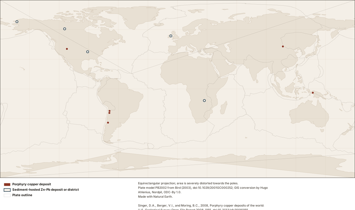
World map with twelve small symbols — six filled dark-red circles for porphyry copper deposits in the Andes, western North America, New Guinea and Mongolia, and six open circles with dark outlines for sediment-hosted zinc-lead deposits and one district in North America, Ireland and central Africa — over faint grey plate outlines and a pale coastline.
The twelve records — eleven deposits and one mineral district — for which Lithoen holds a sourced coordinate, over faint plate outlines. Every symbol is the same size: a famous deposit does not get a bigger dot, because symbol size would have to encode a metric and the only metrics available are compiler totals with different definitions in the two databases. Thirteen further deposits in this corpus have no sourced coordinate and do not appear here at all. There is no shading, no interpolation and no density surface. This is a map of records held, and where the symbols cluster is where the compilations looked.

Figure by Lithoen. Plate model PB2002 from Bird (2003), doi:10.1029/2001GC000252; GIS conversion by Hugo Ahlenius, Nordpil, ODC-By 1.0. Made with Natural Earth. Singer, D.A., Berger, V.I., and Moring, B.C., 2008, Porphyry copper deposits of the world: U.S. Geological Survey Open-File Report 2008-1155, doi:10.3133/ofr20081155. Singer, D.A., Berger, V.I., and Moring, B.C., 2009, Sediment-hosted zinc-lead deposits of the world: U.S. Geological Survey Open-File Report 2009-1252, doi:10.3133/ofr20091252. Underlying data remain under their own licences. · LITHOEN-ORIGINAL · Derivative: Generated from published Lithoen spatial records by scripts/generate-maps.ts; no coordinate was edited by hand. Deposit symbols are drawn at a fixed radius. No quantity is encoded in symbol size, because the tonnage figures available are compiler totals whose definitions differ between the two databases and are not comparable with one another.

Classification

recognition basis
authoritativeDatabase
realm
asia

What this record is, and who says so

Recognised on the basis of

Authoritative database

A curated deposit database published by a scientific institution, in which inclusion is itself a documented editorial decision with stated criteria.

A deposit is an occurrence of sufficient size and grade that it might, under the most favourable circumstances, be considered to have economic potential. Lithoen records that a named authority made that judgement. It is not a statement that anything here is recoverable, and it is not a resource or a reserve.

How it is interpreted

A deposit is not a mineral system. A source interprets it as an example of one, and interpretations change while the rock does not.

  • Interpreted as an example of Porphyry copper system

    By — USGS Open-File Report 2008-1155, which records this deposit with deposit-type code "20c" in a codeset it attributes to Cox and Singer (1986). Lithoen reads the record as an example of the porphyry copper system because the database is titled and scoped to porphyry copper deposits, not because it has verified what the code expands to.

    The interpretation belongs to the source named in the model qualifier, not to the deposit. Another author may classify this body differently, and the record holds the interpretation rather than replacing the object with it.

Commodities documented here

  • Copper (commodity)documented association

    The source documents the commodity in this deposit and states no economic role. Lithoen records the association and infers nothing about how it would be worked.

  • Gold (commodity)documented association

    The source documents the commodity in this deposit and states no economic role. Lithoen records the association and infers nothing about how it would be worked.

Reported figures, and what each one is

A sample assay, a deposit average, a compiler total and a reported reserve are different quantities. Each figure below carries which one it is; none of them is a current resource or reserve.

4,000 Mt

Compiler total, for modelling

effective 2008-01-01

A sum assembled by a database compiler from production plus reserves plus resources at the lowest available cut-off, so that deposits can be compared in a grade-and-tonnage model. It is not a resource, not a reserve and not production; it is a modelling quantity, and the USGS databases Lithoen reads define their tonnage exactly this way.

The USGS porphyry copper database gives Grasberg an ore tonnage of 4000 million metric tons. That figure is a compiler total: total tons of ore based on total production, reserves and resources at the lowest possible cut-off grade, assembled so that deposits can be compared in a grade-and-tonnage model. It is not a resource, not a reserve and not production.

0.6 wt%m Copper

Deposit average

effective 2008-01-01

An average grade attributed to a whole deposit by a compiler, over a tonnage defined by that compiler at a stated cut-off. Not a measurement of anything: a summary of an estimate.

The USGS porphyry copper database gives Grasberg an average copper grade of 0.6 percent. The compilers define this as the average grade of that metal for the deposit as a whole, over the ore tonnage they record — a deposit average, not an assay and not a reported resource grade.

The source records behind this

What one row of a published dataset was taken to mean, and why. The original record stays traceable after reconciliation.

  • Porphyry copper deposits of the world (USGS OFR 2008-1155), record 296

    Named there
    Grasberg
    The source calls it
    deposit
    Lithoen reads it as
    deposit (stated)

    The dataset states that one row is one deposit, defined operationally as all mineralised rock or alteration within two kilometres combined, and that the compilation deliberately excludes occurrences without economic potential. This row is read as the deposit Grasberg, at the identity the compilers gave it — including any bodies they merged, which are carried on the mapping.

    Merged into this row by the compilers: Ertsberg, Gunung Bijih, Kusing Liar. Those names were combined under the dataset’s own two-kilometre rule before Lithoen read it.

    Read and refused

    • grade columns with a value of zero — In both USGS deposit databases a grade of zero means the value was unavailable, not that the grade is zero. Reading it as a measurement would publish a false number.
    • decimal-degree columns beyond the authored precision — The decimal-degree columns carry floating-point residue from the degrees-minutes-seconds columns that were actually authored. The point is emitted at the authored precision instead.

How this is mapped

One published representation of where Grasberg is. Each is one interpretation, by one identified source, at one scale — not the shape of the thing itself.

  • Representative point

    Point · 1 positionspreferred for publication

    A single position standing for something that is not a point. It exists so a feature can be shown on a map or listed by location, and it asserts NOTHING about extent. A representative point for a 2,000 km province is a label anchor, not a location.

    A representative point for Grasberg from the USGS porphyry copper database. It is a label anchor, not an extent and not a shaft: the compilers placed these positions against satellite imagery, and this row was authored in degrees and minutes, so the position is stated to about 1.8 km. A porphyry deposit is commonly kilometres across, and no polygon exists here because none was published.

    Boundary certainty
    ApproximateThe position is known only within a distance much larger than the line width on any map that shows it. Drawing it thinner does not make it better known.
    Status of this geometry
    inferredThe status of the geometry, which need not match the status of what the entity’s claims assert.
    Dataset
    Porphyry copper deposits of the world (USGS OFR 2008-1155)Singer, D.A., Berger, V.I., and Moring, B.C., 2008, Porphyry copper deposits of the world: U.S. Geological Survey Open-File Report 2008-1155, doi:10.3133/ofr20081155.

    What was done to this geometry

    • By Lithoen — Rounded to 2 decimal places, the precision the compiler authored: this row was recorded in degrees and minutes, so the position is stated to about 1.8 km. The dataset's decimal-degree columns carry more digits, which are conversion residue rather than knowledge.
    • Before it reached Lithoen — The compilers revised locations for the 2008 release so that they are consistent with images in Google Earth; the position is their placement, not a survey.
    • Before it reached Lithoen — Named bodies within two kilometres were combined into one deposit by the compilers before Lithoen read the row.

How this record is known

4
Settled consensus
Cited as the accepted position of the discipline.

4 of 4 claims on this page cite at least one registered source. Counts describe how each statement is known, not how likely it is to be true.

What Lithoen records

Each claim states how it is known and cites its evidence.

EstablishedDeposit-type code "20c", in a codeset the metadata attributes to Cox and Singer (1986).

How a source classifies it

The USGS porphyry copper database records Grasberg with deposit-type code "20c". The metadata defines the field as a classification "using a system new to this report using the observed rocks reported in maps rather than characteristics that are frequently unobservable in yet-to-be discovered deposits", and gives its domain as a codeset reference — Cox and Singer (1986), doi:10.3133/b1693 — rather than as an enumeration. The metadata expands no code. Lithoen therefore records the code and its stated codeset, and does not state what "20c" means.

  • model: USGS Open-File Report 2008-1155, deptype field.
  • source record: record grasberg-deposit
  • precision note: Bulletin 1693 has not been retrieved, so the expansion of this code into a named deposit type is unverified and is not asserted. An earlier version of this claim gave one — that expansion came from general knowledge, not from any source Lithoen had read.
  • assertion basis: SOURCE_CLASSIFICATION

Evidence support: Supported by the cited evidence 2 sources, single source

Evidence: Singer 2008 Primary authority

Established0.6 wt%m Copper

Reported for this deposit

The USGS porphyry copper database gives Grasberg an average copper grade of 0.6 percent. The compilers define this as the average grade of that metal for the deposit as a whole, over the ore tonnage they record — a deposit average, not an assay and not a reported resource grade.

  • scope: depositAverage
  • definition basis: The dataset’s attribute definition, which also states that a value of zero means the grade was unavailable.
  • source record: record 296
  • effective date: 2008-01-01
  • assertion basis: SOURCE_REPORTED

Evidence support: Supported by the cited evidence 2 sources, single source

Evidence: Singer 2008 Primary authority

EstablishedRecognised as a deposit by USGS Open-File Report 2008-1155, record 296.

How a source classifies it

Grasberg is recorded as a deposit because the USGS porphyry copper database includes it, as record 296. That database admits only well explored deposits with enough information to help construct deposit models, and deliberately excludes occurrences without economic potential — so inclusion is itself a documented editorial judgement with stated criteria, made by identified compilers and not by Lithoen.

  • source record: dataset:usgs-porphyry-copper-deposits-of-the-world record 296
  • definition basis: The compilers’ stated inclusion criteria, quoted in the cited evidence.
  • assertion basis: SOURCE_CLASSIFICATION

Evidence support: Supported by the cited evidence 2 sources, single source

Evidence: Singer 2008 Primary authority

Established4,000 Mt

Reported for this deposit

The USGS porphyry copper database gives Grasberg an ore tonnage of 4000 million metric tons. That figure is a compiler total: total tons of ore based on total production, reserves and resources at the lowest possible cut-off grade, assembled so that deposits can be compared in a grade-and-tonnage model. It is not a resource, not a reserve and not production.

  • tonnage category: compilerTotalForModelling
  • definition basis: The dataset’s own attribute definition for oreton, quoted in the cited evidence.
  • source record: record 296
  • effective date: 2008-01-01
  • precision note: Effective at the 2008 publication of the database. Later production and later estimates are not reflected, and this figure must never be described as current.
  • assertion basis: SOURCE_REPORTED

Evidence support: Supported by the cited evidence 2 sources, single source

Evidence: Singer 2008 Primary authority

In the knowledge graph

Record last updated 2026-09-07. Corrections follow the published corrections policy; superseded claims are retained, never silently edited.