Also known as New Lead Belt, Viburnum Trend district
A belt of carbonate-hosted lead-zinc deposits in southeastern Missouri, in the district the Mississippi Valley-type class is named after. Lithoen records it as a district rather than a deposit: the USGS database holds it as one row while listing separate named orebodies merged into it, and the USGS Mississippi Valley-type model states that districts of this class consist of several to as many as 400 deposits.
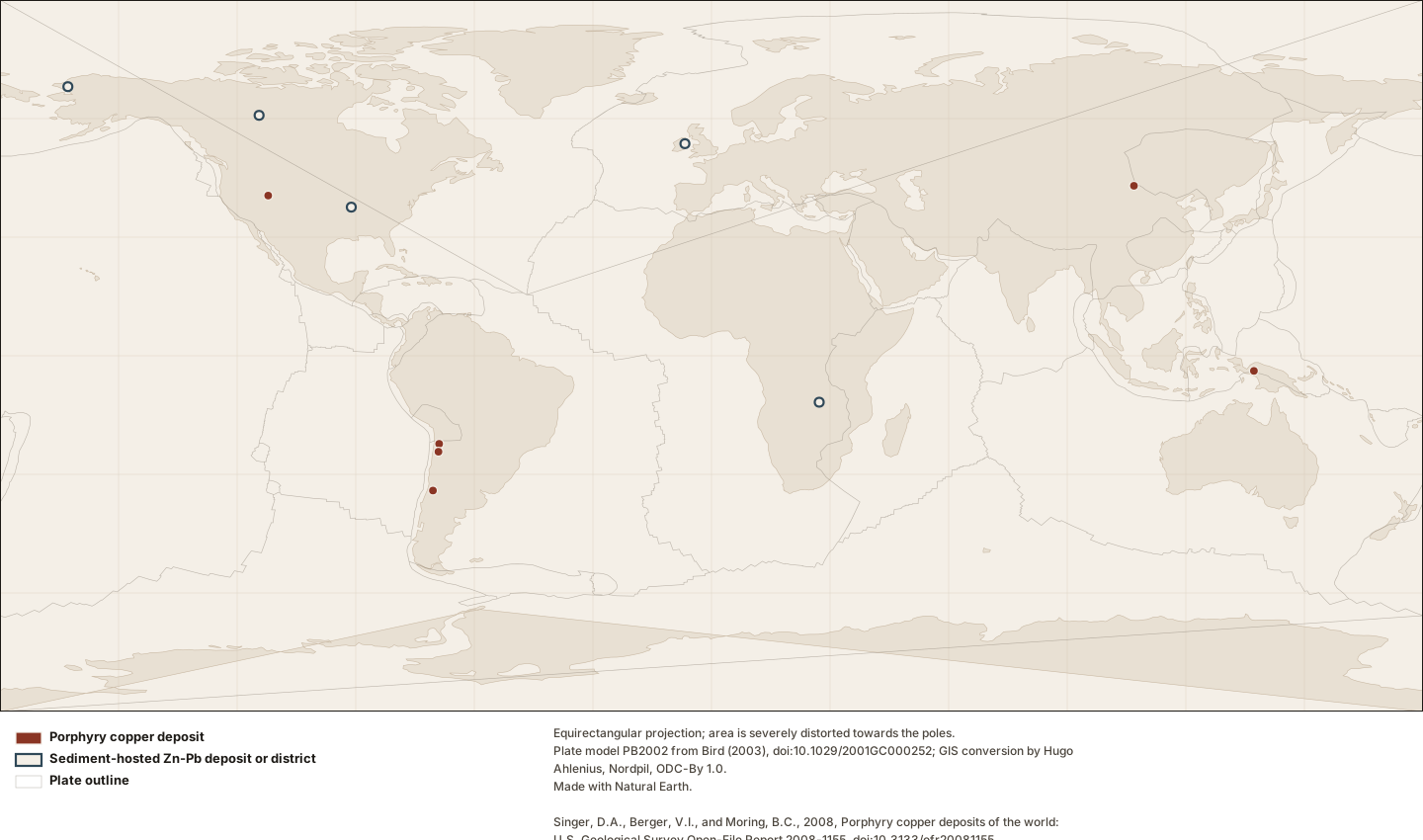
The twelve records — eleven deposits and one mineral district — for which Lithoen holds a sourced coordinate, over faint plate outlines. Every symbol is the same size: a famous deposit does not get a bigger dot, because symbol size would have to encode a metric and the only metrics available are compiler totals with different definitions in the two databases. Thirteen further deposits in this corpus have no sourced coordinate and do not appear here at all. There is no shading, no interpolation and no density surface. This is a map of records held, and where the symbols cluster is where the compilations looked.
Figure by Lithoen. Plate model PB2002 from Bird (2003), doi:10.1029/2001GC000252; GIS conversion by Hugo Ahlenius, Nordpil, ODC-By 1.0. Made with Natural Earth. Singer, D.A., Berger, V.I., and Moring, B.C., 2008, Porphyry copper deposits of the world: U.S. Geological Survey Open-File Report 2008-1155, doi:10.3133/ofr20081155. Singer, D.A., Berger, V.I., and Moring, B.C., 2009, Sediment-hosted zinc-lead deposits of the world: U.S. Geological Survey Open-File Report 2009-1252, doi:10.3133/ofr20091252. Underlying data remain under their own licences. · LITHOEN-ORIGINAL · Derivative: Generated from published Lithoen spatial records by scripts/generate-maps.ts; no coordinate was edited by hand. Deposit symbols are drawn at a fixed radius. No quantity is encoded in symbol size, because the tonnage figures available are compiler totals whose definitions differ between the two databases and are not comparable with one another.
Classification
region kind
mineralDistrict
domain realm
northAmerica
How this is mapped
One published representation of where Viburnum Trend is. Each is one interpretation, by one identified source, at one scale — not the shape of the thing itself.
Representative point
Point · 1 positionspreferred for publication
A single position standing for something that is not a point. It exists so a feature can be shown on a map or listed by location, and it asserts NOTHING about extent. A representative point for a 2,000 km province is a label anchor, not a location.
A representative point for Viburnum Trend from the USGS sediment-hosted zinc-lead database. The compilers state that a location here "is intended to plot within the alteration zone of deposit which may be kilometers across" — so the point is inside a zone, not the centre of one and not a shaft. This row was authored in degrees, minutes and seconds, giving a position stated to about 30 m.
Boundary certainty
ApproximateThe position is known only within a distance much larger than the line width on any map that shows it. Drawing it thinner does not make it better known.
Status of this geometry
inferredThe status of the geometry, which need not match the status of what the entity’s claims assert.
Dataset
Sediment-hosted zinc-lead deposits of the world (USGS OFR 2009-1252)Singer, D.A., Berger, V.I., and Moring, B.C., 2009, Sediment-hosted zinc-lead deposits of the world: U.S. Geological Survey Open-File Report 2009-1252, doi:10.3133/ofr20091252.
What was done to this geometry
By Lithoen — Rounded to 4 decimal places, the precision the compiler authored: this row was recorded in degrees, minutes and seconds, so the position is stated to about 30 m. The dataset's decimal-degree columns carry more digits, which are conversion residue rather than knowledge.
Before it reached Lithoen — All deposit locations were checked by the compilers against Google Earth imagery, and many differ substantially from previously published locations as a result.
Before it reached Lithoen — Named bodies within two kilometres were combined into one row by the compilers before Lithoen read it.
How this record is known
1
Settled consensus
Cited as the accepted position of the discipline.
1
Interpretation
Reached by reasoning from evidence, or produced by a named model.
2 of 2 claims on this page cite at least one registered source. Counts describe how each statement is known, not how likely it is to be true.
What Lithoen records
Each claim states how it is known and cites its evidence.
EstablishedNamed sub-types exist in the literature and this model declines to use them.
General principle, shown here for context — not an observation about this record.
Alternative classifications have been proposed for Mississippi Valley-type deposits by geography or local feature — Appalachian, Alpine, Reocin, Irish and Viburnum Trend types among them. The USGS model records them and rejects them: "we do not consider these alternative classifications or sub-types to be sufficiently different to warrant using them."
precision note: A useful reminder that a deposit named as a type is not thereby a type. Lithoen carries the model’s refusal rather than the sub-type names.
generality: GENERAL_PRINCIPLE
Evidence support: Supported by the cited evidence· one source
InferredOne source row, read as a district rather than a deposit, on the model’s own account of district size.
General principle, shown here for context — not an observation about this record.
The Viburnum Trend is held as a district and not as a deposit. The USGS sediment-hosted database presents it as one row, which its own documentation says is one deposit — but the row lists separate named orebodies merged into it, and the USGS Mississippi Valley-type model states that districts of this class consist of several to as many as 400 deposits. Lithoen reads the row against the model rather than against the row definition, and records the reinterpretation on the mapping with the confidence marked as inferred from documentation.
method: Comparison of the dataset’s row definition against the deposit model’s statement about district composition.
precision note: This is a Lithoen interpretation of a source row, not a correction of the source: the compilers were building grade-and-tonnage models, for which a trend is a legitimate sampling unit.
generality: GENERAL_PRINCIPLE
Evidence support: Supported by the cited evidence· 2 sources, multiple sources, independence unknown