Geological region
Laptev Sea diffuse deformation zone
A zone of distributed deformation where the Arctic spreading system meets the Siberian margin and the boundary between the Eurasian and North American plates becomes indistinct.
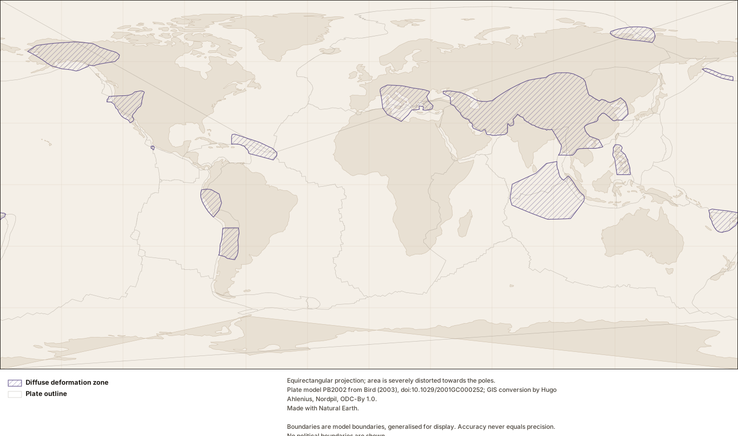
Figure by Lithoen. Plate model PB2002 from Bird (2003), doi:10.1029/2001GC000252; GIS conversion by Hugo Ahlenius, Nordpil, ODC-By 1.0. Made with Natural Earth. Underlying data remain under their own licences. · LITHOEN-ORIGINAL · Derivative: Generated from published Lithoen spatial records by scripts/generate-maps.ts; no coordinate was edited by hand. Features spanning ±180° are split for rendering only; the stored geometry is unchanged.
Classification
- region kind
- diffuseDeformationZone
- domain realm
- asia
How this is mapped
One published representation of where Laptev Sea diffuse deformation zone is. Each is one interpretation, by one identified source, at one scale — not the shape of the thing itself.
Tectonic model geometry
Polygon · 28 positionspreferred for publicationGeometry that exists because a model defines it — a rigid-plate outline, a zone where a model declares itself inapplicable. It is a property of the model, and changes when the model is revised. It is present-day geometry from a present-day model; a palaeogeographic reconstruction is a different thing and Lithoen does not hold one.
The outline of the "Laptev Sea" orogen in model PB2002 (Bird, 2003). In that model an orogen is a region where the rigid-plate description does not apply because deformation is distributed, so this outline delimits where a MODEL stops working — it is not the extent of a mountain belt and carries no claim about crustal structure, age or thickness. Digitised by by Peter Bird, May 2002.
- Boundary certainty
- DefinedThe boundary is fixed by a definition rather than found in the field — a model boundary, a stated coordinate limit, an administrative extent of a survey. It is exactly where it says it is, because it is a definition.
- Status of this geometry
- modelledThe status of the geometry, which need not match the status of what the entity’s claims assert.
- Dataset
- PB2002 plates, boundaries and orogens as GeoJSON (fraxen/tectonicplates)Plate model PB2002 from Bird (2003), doi:10.1029/2001GC000252; GIS conversion by Hugo Ahlenius, Nordpil, ODC-By 1.0.
What was done to this geometry
- By Lithoen — Coordinates rounded to 4 decimal places, about 11 m of longitude at the equator.
- Before it reached Lithoen — Digitised by Peter Bird for model PB2002; the outlines delimit where the model declares itself inapplicable.
- Before it reached Lithoen — The GIS conversion (Ahlenius, ODC-By 1.0) split segments spanning the -180/180 meridian and moved them, as its README states.
Record last updated 2026-09-07. Corrections follow the published corrections policy; superseded claims are retained, never silently edited.